This particular hike was inspired by an MMK role portrayed by Erich Gonzales as a mountaineer. I didn't see it but my colleagues did and excitedly did the research of the place and show us the photos and the sea of clouds view. Since I enjoy trekking and mountains, I excitedly count myself in when the the group started to plan this climb. We were rooting to catch the sea of clouds. We wanted to do it for Mt. Pulag for so long but it was too far from us so when we found out the Mt. Batolusong sea of clouds version, we all want to jump off immediately. But spoiler alert, we didn't catch the sea of clouds. Hahaha!
LOCATION
Mt. Batolusong is located at Tanay, Rizal, a 2-3 hours ride from Manila. We rented a van and left Makati at around 3 AM. We passed by Marikina and Cogeo. Jump off was at Brgy. San Andres, Tanay, Rizal. This was were the sea of clouds dreams started shattering. Following the waze, we were directed into a stiff and narrow road without any houses around. It was still dark at that time and there was no one to ask for a direction. The road side were full of tall grasses. Realizing that we were going to a dead end, we went backward since we can't maneuver with the little stiff road. We found a man near the exit and asked for direction. Found out we really got it wrong and we need to return back in a road again. So yeah, goodbye sea of clouds.
To be able to catch the sea of clouds, you need to be at the peak at around 6-7am. The reason why some of the hikers choose to camp out and spend a night at any of the summits. Mt. Batulosong has 3 summits. First summit took about an hour to reach while the 2nd was about 30 minutes and another 20 minutes for the peak. A total of 2 hours trek, but still depends on your pace. Mt. Batolusong is considered minor hike with 3/9 difficultly and 1-3 trail class based on Pinoy Mountaineer.

We started at the base camp. Everyone was required to list their names and pay the environmental fee. Guides will be assigned to every group depending on the size.
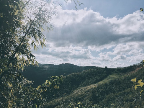
1st Summit | D u h a t a n R i d g e
The ascend was not that stiff but it was a long trek. There are 4 phases to reach the 1st summit. Though it will be on your own pace and you can rest on every phase, they were not a joke. One of us almost fainted. Found out he has a high blood.


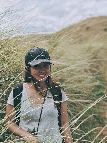
Already out of breath at the 1st phase. :D


If you reach this rocky hill that was in the middle of a grass fields, it means you reach the last phase of the 1st summit. Congratulations, but not yet! Another 15 minutes to the 1st summit. But reaching this height means a lot of photo opportunity with now visible beautiful surroundings.

The squad.


A store will be waiting before you reach the 1st summit where you can refresh and rest. They have cold drinks and snacks. Just be mindful with your garbage.


They owned a monkey. Though it will be nice to play with it, don't get too close especially if you're holding a food, he will grab it without hesitation.


From the store, the trek will be a little stiff. It will be quite a struggle before you reach the Duhatan Ridge. But a little more push and you will be there.


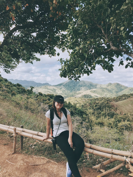
Once you see this two big trees and a bench in between, with an overlooking hills around, you reach the first Summit. Hurray! Welcome to Duhatan Ridge!
If you're wondering, duhat is a kind of fruit, and yes, it is edible. And the ridge has a line of duhat trees. We didn't see any fruits on the trees though during our hike. Not on its season maybe.


The hills and unending greens around the ridge was so pretty. Just on the 1st summit and I'm already in loved. I wondered what surprise was waiting for me on the next summit.

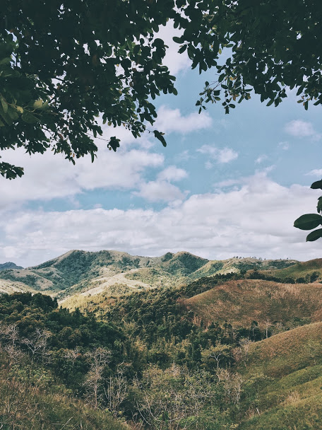


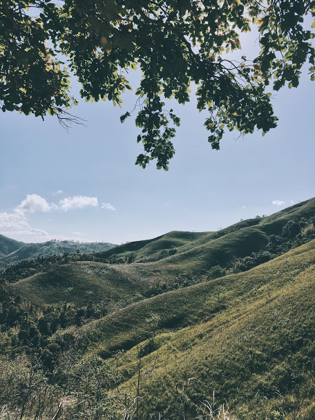
2nd Summit | M a p a t a g P l a t e a u
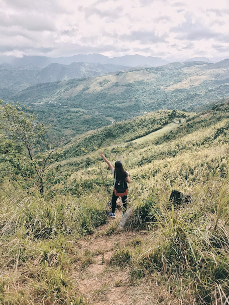
With the word mapatag which means flat and smooth, indeed the Mapatag Plateau was mostly smooth and flat trail unlike the struggle we experienced to reach the 1st Summit. Mapatag Plateau was beautiful with its unending field of grass and mountain views from afar. We can't help but take a lot of photos that made the trek longer than the usual. No regrets!

Hurray for the 2nd Summit!


It was windy at the top but still better to reach the Mapatag Plateau at the morning or late noon. It was a long flat of grass fields and there were no trees that can provide a shield against the burning sun.


Stunning!


3rd Summit | B a t o l u s o n g P e a k
After a lot of photo ops at Mapatag Platue, we reached a small nipa hut store at the end of the 2nd summit and decided to rest for a while and take our lunch. Since it was the only shaded area in the place, it became a sanctuary for all the hikers, some stopped to rest and take a nap. There was also a comfort room with 5.00 fee for your service. Other groups that were there already completed the trek and was about to go back.

After our sumptuous lunch, we started ascending again. Going to the last summit will take another 15-20 minutes of trekking on an uneven heights.


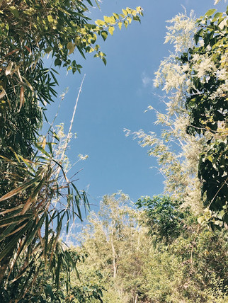


There was a nice little bamboo forest along the way. It means, we were almost at the end of the trek.

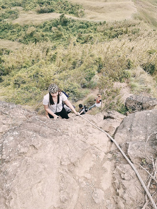
And so we reached our final ascend. This almost 90 degrees stone hill will be the final blow (I'm talking about the ascend. Descend will be another story. Lol). In able to climb, you need to carry your weight using a rope. It was scary at first since once you loose your grip, the drop will be really painful and maybe deadly. But relax, it was manageable! The hill was not that long to reach. And those uneven stones can really help you with your steps. Just take your time and be calm.


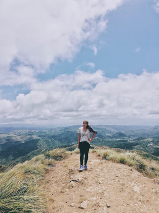


Yey, Got it to the top. I'm the queen of the world! Char! :D
DETOUR | KAY-IBON FALLS
This detour is optional, if you still have the energy. But from the beginning, our group already discussed that we will take a dip at Kay-ibon falls before we go home. Reaching the falls takes about 15 minutes from the Duhatan Ridge Summit.


We got a nice dip and took a little time to cool of in the cold water of Kay-ibon Falls.
We might went to witness the "sea of clouds" but Mt. Batolusong was definitely more than the "sea of clouds". We went home exhausted and satisfied. And though it was considered as minor hike, perseverance was needed. Not everyone succeeded to continue until the lat summit. Reaching the 1st summit was the hardest and Mapatag Plateau has the most stunning view for me. Kay-ibon falls was a good detour place but can be skipped.
Mountain Essentials
Water (a lot)
Food/Snack
Towel for the sweat
Sunscreen
Sun visor or any sun gear
Hiking shoes
Extra clothes from top to bottom
Comments